
MILWAUKEE — Most of Wisconsin is under threat of severe weather Wednesday, July 14, 2021, according to the National Weather Service in Milwaukee.
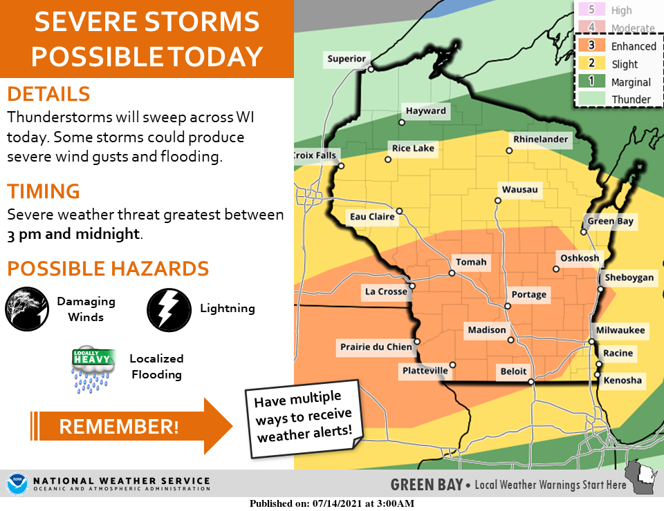
The greatest threat is in the mid-part of the state, while areas north of Rice Lake and Rhinelander face only a marginal threat.
The National Weather Service office says there will likely be two main rounds of strong to possibly severe storms later today and into tonight for most of the southern half of the state.
With the first round, beginning about 1 p.m., damaging winds will be the main concern as it moves east later in the afternoon and evening hours.
With the second round, beginning about 8 p.m., there remains uncertainty in how strong convection will be as it will be highly dependent on how the first round evolves.
Heavy rain may lead to flooding concerns, especially in urban areas and if our dry soil/ground cannot absorb precipitation efficiently due to high rainfall rates.
Portions of southern Wisconsin *could* see 1-3” of rain by tomorrow morning. Below are some estimated arrival times for the various rounds of storms today into tonight.
The northern half of the state will see the greatest threat between 3 p.m. and midnight.
.